Roads linking the Northern Cape to the rest of the country are already showing signs of strain as heavy rain threatens to flood low-lying routes. For small transport firms and retailers that depend on timely deliveries, a blocked highway can mean missed orders and lost revenue.
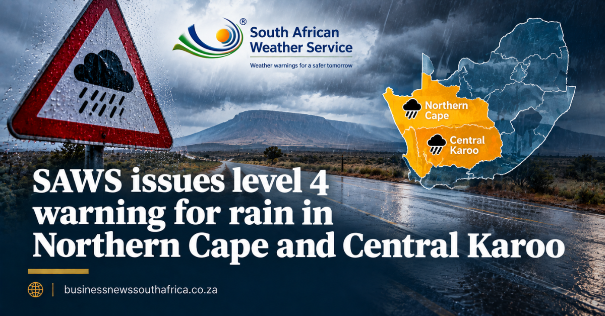
The South African Weather Service (SAWS) said it has issued a Yellow Level 4 warning for disruptive rain in the eastern Namakwa region of the Northern Cape and the Central Karoo district of the Western Cape. A Yellow Level 4 warning is the highest alert for rain, indicating a strong likelihood of flooding that could close roads and affect settlements.
In addition, SAWS placed Yellow Level 2 warnings on a string of municipalities, Nama Khoi and Kamiesberg in the Northern Cape, the West Coast, Cape Winelands, Overberg districts and the City of Cape Town, for severe thunderstorms with excessive lightning. The service also warned of damaging winds in the North West, eastern parts of the Northern Cape, central and western Free State, central and western Limpopo and northern Eastern Cape. Those winds could damage informal settlements, knock down power lines and interrupt communications.
Further Level 2 alerts cover Port Edward, Richards Bay and nearby interior areas, where strong winds and waves may briefly disrupt small harbours and ports. A Level 1 warning for the Eastern Cape adds the risk of severe thunderstorms and damaging winds that could harm temporary structures and cut power.
SAWS’s colour-coded system is designed to give businesses a clear signal of the severity of an approaching weather event. While Level 4 is reserved for rain that is likely to cause widespread flooding, Level 2 signals that hazards such as lightning, wind or waves are probable but not yet certain. The agency also flagged very high fire danger in the western Waterberg district and Blouberg municipality of Limpopo, a reminder that dry conditions can follow the storms.
For owners of small enterprises, the practical steps are simple: review delivery schedules, consider alternative routes, and communicate possible delays to customers. Secure loose stock, reinforce roof structures, and check that generators are ready in case of power cuts. If you have insurance that covers weather-related loss, confirm that the policy still applies to the specific perils listed in the warnings.
Because the warnings cover a wide swathe of the country, the ripple effect on supply chains could be felt beyond the immediate zones. Keeping an eye on SAWS updates and having a contingency plan can help minimise the financial hit when the rain arrives.
SAWS issues coded warnings, yellow, orange and red, based on the likely impact and probability of severe weather, a system used by disaster management authorities, municipalities and increasingly by insurers and logistics companies planning ahead of a storm. The South African Weather Service’s own warning system carries further detail. For related coverage, see this site’s Regulatory and Policy coverage.
Provinces most exposed to a warning like this typically activate their own joint operations centres, coordinating between the weather service, emergency services and municipal disaster management teams so that road closures and shelter arrangements can be communicated to the public as conditions develop.
Farmers and logistics operators in the affected provinces typically adjust planting, harvesting and delivery schedules around a warning of this kind, since heavy rain can delay fieldwork or damage crops close to harvest even where flooding itself does not reach populated areas.
The Central Karoo and Northern Cape’s sparse road network means a single washed-out low-water crossing can cut off a town for days until floodwaters recede and repair crews can reach the site, a logistical reality that has shaped how seriously local municipalities in the region tend to treat a level 4 warning even when the population directly affected is relatively small.